- This topic has 6,423 replies, 23 voices, and was last updated 3 weeks, 1 day ago by
 Proclaimer.
- AuthorPosts
- May 3, 2019 at 2:35 pm#845152
 mikeboll64Blocked
D4T, they’re all asking for the eye height and distance. 😆 It’s like they don’t understand the point of the challenge. I’ll be on a live stream with dazzathecameraman to discuss it. I’ll put a notice here when we set the time.
May 3, 2019 at 11:13 pm#845161 Dig4truthParticipant
And they say FE people are dull! “Just give me the eye height and distance and I can tell you the distance!” 🤔
May 4, 2019 at 2:27 am#845163 GeneBalthropParticipant
Mike…..as I understand it we can’t reach apsolute zero vaccum, because no matter can withstand that without colasping.
Have you considered that pressure is like a liquid say water for an example, if you were to build a dam to hold back water at the depth of 200 feet and the water went back 10 miles, would it require a equally as large a dam if the water was only 10 feet away from the face of the dam at the same 200 ft depth , yes or no. And explain your answer.
I am not even sure if this has anything to do with what you descussing right now. But if it is pressure it might help, and what does this have to do with is the earth being round or not? Seems to me none of this has to do with, is the earth round or flat.
Peace and love to you and yours. ……gene
May 5, 2019 at 5:12 am#845174 mikeboll64Blocked
Discussing T8’s Mount Ruapehu photo with New Zealander dazzathecameraman 5-4-19 at 00:00 UTC time…
May 5, 2019 at 10:52 pm#845181 Dig4truthParticipant
Great job on the challenge video Mike!
May 6, 2019 at 6:53 am#845186 mikeboll64Blocked
Thanks D4T! Here’s the short follow up video to the live stream…
May 6, 2019 at 11:47 pm#845191 Dig4truthParticipant
You know that we have shown scientifically (observable, testable and repeatable) how the bottom of objects compress and are obscured by refraction, basically the water in the atmosphere acting as a magnifying lens. But as the saying goes, “there are none so blind as those who will not see“, which seems very applicable in this instance.
May 7, 2019 at 10:07 am#845193 ProclaimerParticipant
This will be interesting.
May 7, 2019 at 10:21 am#845194 ProclaimerParticipant
Chicago skyline
I agree that the news presenter offers no evidence, but that is because it is not a science show and each news clip is brief for reasons of time. But look at the facts:
- There is a ton of evidence in the form of photos, videos, mathematics, large objects dropping over the horizon, as well as boat, ship, and aircraft navigation times and routes. There are also testable experiments people can do for themselves.
- Why would light only travel in straight lines with no refraction above water? It wouldn’t. Think about it. Light from the stars travels at the speed of light so we are witnessing them from the past. If the stars we see are not really that way the moment we view them, then why would anyone think that light bouncing around the atmosphere would only ever be perfectly straight. Guess what, that doesn’t happen always and especially where water is involved. And have you noticed that water is in nearly all these pics you offer as evidence?
- If Chicago and Ruapehu are visible because the Earth is flat, then why are they not visible most of the time? Atmospheric interference? lol.
The reality is Mike, that you have failed to prove that there is a conspiracy here because that is the only feasible explanation of a flat earth given the ton of evidence available. And this conspiracy in itself is so preposterous in itself that the evidence to prove it would have to be extraordinary. But you offer zero evidence of a worldwide conspiracy involving millions of people who work for space agencies, satellite organisations, and Antarctic protection fleets.
Mike, you are not convincing anyone who is open minded about truth and has a reasonable grasp of science. All you are doing is sitting in an echo chamber of like-minded conspiracy theorists who are patting each other on the back.
May 7, 2019 at 10:30 am#845195 ProclaimerParticipant
Posting this to watch later.
May 7, 2019 at 4:36 pm#845198 ProclaimerParticipant
Okay, I watched this and I think it is fair to say Mike that they debunked the notion that this image is proof of a Flat Earth. Rather as they say, the image lines up with a Globe Earth.
I thought the guys you debated were respectful and didn’t bring up refraction as the answer because that was somehow not allowed, but then you brought up compression even when it went against your own rules, but I feel you did it because they made a great point about how half the mountain wasn’t visible under the tree line.
Most of the points I had already brought up, so it was good to see that they were valid points being brought up by people who spent way more time and effort on this than me, but it was better than my argument in the sense that they poked holes in some of the math you presented which I did not.
Yes, I think his image that he superimposed on my photo was not to scale, but regardless, what matters is around half of the height is still missing below the tree line there is no question about that. The tree line definitely doesn’t represent the halfway point does it?
May 7, 2019 at 4:44 pm#845199 ProclaimerParticipant
The other thing that you argued was that people resort to refraction based on their premise that the earth is a globe, so they start with the conclusion, but then they argued this successfully without refraction and for some reason you got upset about the refraction thing. But that didn’t do anything for the Flat Earth argument and they pointed out that refraction would play a little part only, if there was refraction.
My earlier answer was refraction makes up the difference after I pointed out that the plateau needed to be factored in lessening the 67% figure you gave. And yes I brought up refraction because of my view that the earth is a globe, but I also pointed out that within the range I was suggesting that refraction may not even be needed to explain it. And these guys did just that. They explained it without refraction even though refraction took place to some degree as it is unlikely that there was zero refraction. So if there was refraction, then that gives more ammunition to the Globe.
I believe I can place this in the Debunk List and move onto another point now.
May 7, 2019 at 8:49 pm#845201 ProclaimerParticipantMay 7, 2019 at 9:57 pm#845202
 ProclaimerParticipant
Mike’s Ruapehu hypothesis is debunked

Hi Mike. So if the tree line is about half way down or up the mountain due to the base being 900 metres high to start with, and if the calculators say that half the mountain should be hidden in my photo of Ruapehu (below), then it adds up right? So my photo actually points to the Earth being a globe given what is visible and what is not.
 May 8, 2019 at 9:42 am#845223
 Dig4truthParticipant
Looks to me like the tree line goes all the way down to the base. So if you can all of the tree line then you are seeing down to the base.
May 8, 2019 at 2:01 pm#845224 mikeboll64Blocked
The entire island from beach to mountain is all squished into that bottom quarter of the picture – exactly how it always works. Here’s a sunset I took in San Diego…
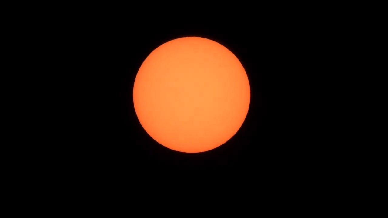
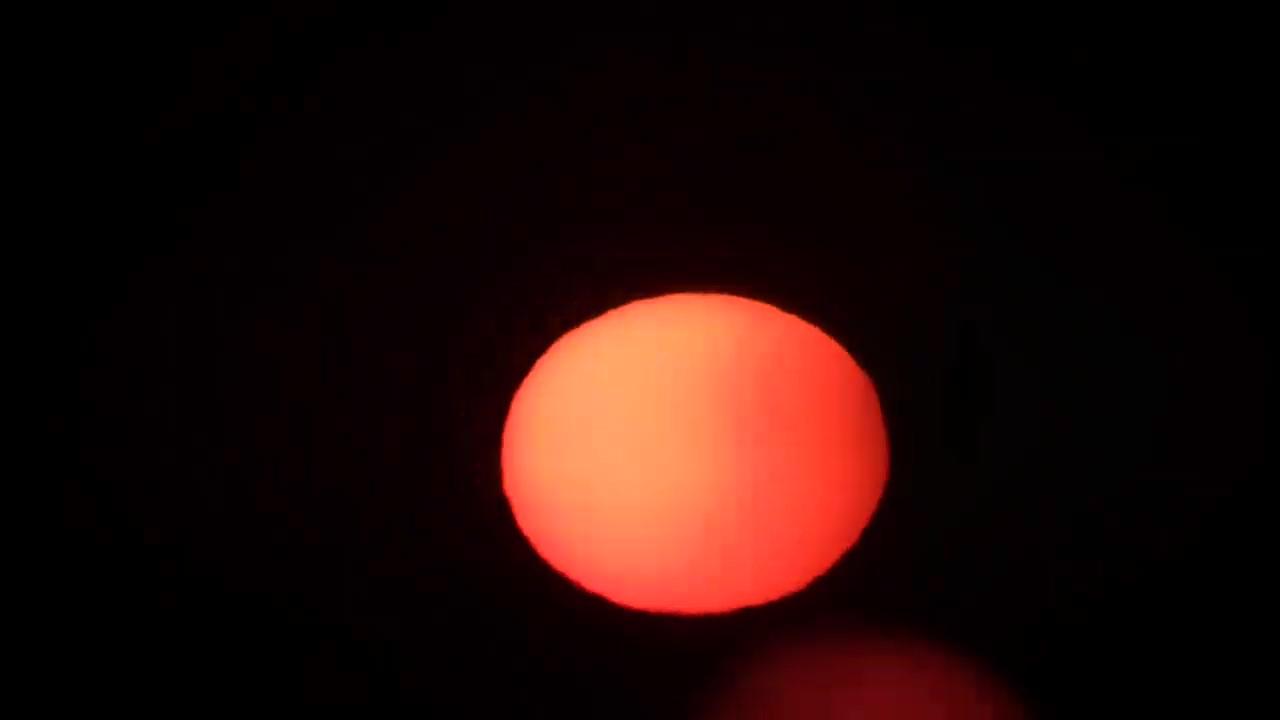
Notice anything different about the second one when the sun is just about to merge with the ocean? You’ll notice the width remains the same, and the top of the sun remains the same. Only the bottom squishes vertically as it hits that thickest layer of atmosphere.
Here’s the same thing with the moon from two weeks ago…
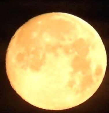
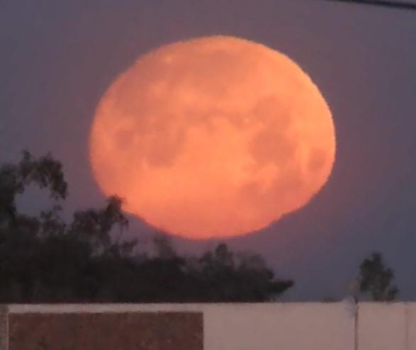
Notice the same compression… only on the vertical – and only at the bottom. The same happens with anything we view from a distance. T8 maybe heard me mention the hotel balconies that another person measured. Many more pixels per balcony at the upper floors than at the bottom. But it’s not like you needed the pixel measurement, because it was easy to see that the lower balconies were visually compressed when compared to the upper ones. I’ll look for that video for you and dazza.
As for the live stream, it wasn’t meant to be a critique of my Mount Ruapehu video… since that had nothing to do with my challenge. I just wanted a distant photo to use. I could have used my Superstition Mountain from 55 miles, but went with your Ruapehu shot. And the only question of the challenge was: Can you tell – from the photo itself – whether it was a mirage or the real mountain? Or does the determining factor of it being a mirage instead of the real thing hinge SOLELY on knowing the distance and eye height so you can first determine whether or not we SHOULD be able to see that thing on a ball earth with a diameter of 3959 miles?
dazza answered directly and honestly. Marcus… not so much – but his answer spoke volumes anyway. Now I’m going back and forth with Mick West (the Metabunk dude) and trying to get a straightforward answer from him… without much luck.
You’re either honest enough to admit what we all know anyway (that there is no test or scientific equipment to determine real from mirage), or you’re not. dazza was, Mark and Mick aren’t. How about you, T8? It doesn’t mean the earth is flat if you admit it. It only shows that you’re honest enough to openly acknowledge that the only “evidence” ball earthers have for claiming a mirage is that it couldn’t be seen on the ball earth.
May 8, 2019 at 6:54 pm#845227 ProclaimerParticipant
Fact: There’s still a whole 590 metres below the tree line. As you drive toward Ruapehu, you slowly ascend 590 metres through rich pastoral land, not forest. Yes there are a few hills with trees, but these hills are hundreds of metres above sea level. I guess around 90% is grasslands. You can see this clearly on Google Maps in satellite mode.
May 8, 2019 at 7:04 pm#845228 ProclaimerParticipant
Mike, I think you were caught in your own craftiness. You mentioned in the live stream video to not use any rescuing devices to avoid the ‘refraction’ answer I assume. Then you introduced a rescuing device yourself near the end when you are on the ropes, that is, ‘compression’.
Yes you did say that you can use real things, but you wanted to avoid refraction and largely your opponents did just that. They demonstrated the math without refraction. But then you went against your own advice and introduced ‘compression’ as your main rebuttal which to my mind is exactly the same as someone using refraction.
May 8, 2019 at 7:11 pm#845229 ProclaimerParticipant
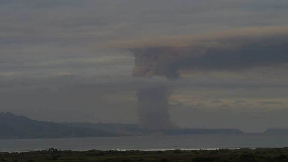
Another rocket launched from Mahia, NZ
Another satellite launched. But don’t tell me it is all a conspiracy, I have a direct family member who played a part in this launch.
 May 8, 2019 at 7:28 pm#845230
 ProclaimerParticipant
Looks to me like the tree line goes all the way down to the base. So if you can all of the tree line then you are seeing down to the base.
The tree line stops around 590 metres above sea level. Our extended family had access to a house in the town of Ohakune, so we were regular visitors some years back. This town is around 590 metres above sea level and the trees start after the town and on the gentle slopes of the lower part of the volcano. The trees basically start around the base of the volcano which is at 590 metres, (not sea level) and as dazza points out, the tree line extends as high as 4500 feet above seal level, (I think it was) which is 1370 metres.
We visited this area for many years and I have walked through many of the trails in the forest and up the slopes of the volcano. I know this area well and know for a fact, that when you head back down toward Wanganui a town to the south and then to Wellington, you are never too far from the coast so you are not too high above sea level. The terrain after Ohakune toward Wellington is mostly pastoral farmland, not forest. In fact, Google Earth or Maps will show that to you. The forest is basically around the volcano only, but as pointed out in the live stream video, the eastern side looks like a desert and western side too but with more sub-alpine tussock grass. The southern view (in the photo) however is forested and then down to pastoral land which extends practically all the way to Paekakariki Hill some 200 km away with a few forested humps and bumps as exceptions.
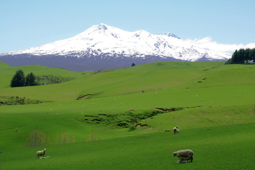
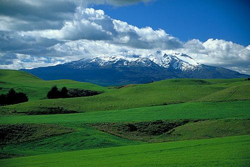
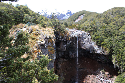
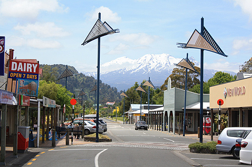
So your observation is wrong Dig. I will post some of my own pics to kind of give you an idea.
The last pic is Ohakune which is 590 metres above sea level. So heading back south to Paekakariki Hill is a descent of 590 to the base of that hill through farm land and of course Paekakariki Hill is around 200 metres above sea level.
The tree line starts around 600 metres above sea level to round it off.
- AuthorPosts
- You must be logged in to reply to this topic.

