- This topic has 6,419 replies, 23 voices, and was last updated 1 month ago by
 Proclaimer.
- AuthorPosts
- January 13, 2020 at 11:01 am#849349
 ProclaimerParticipant
Quick question.
Can lizard people be saved? Or are they 100% the spawn of Satan?
January 13, 2020 at 11:07 am#849350 ProclaimerParticipant
Do YOU have a setting on YOUR camera that allows you to shoot higher quality only where the subject is in the viewfinder? And everything else just gets filled in with crappy 1980s style pixels?
This argument falls flat like your earth when you consider one simple thing. Pixelated images still exist all over the globe. Not just an Antarctic thing. And what do all these areas tend to have in common? Portals to the Hollow Earth? Alien bases? Lizard people in their true form? No, it’s much simpler than that. Small populations. Boom!
This argument of yours is debunked due to lack of evidence and a serious lack of logical reasoning.
Back to the drawing board.
January 13, 2020 at 11:20 am#849351 ProclaimerParticipant
Contrary to what you might think Mike, Google doesn’t have satellites or take the photos themselves. They get the satellite imagery from third party providers. Google Earth wasn’t designed for UFO hunting, pyramid discovery, or flat earth clues. My guess is satellite image providers concentrate their content on populated areas and less so in areas of zero population because there would be a higher demand for images where people live. I don’t know how many times I need to repeat this. Have you grasped my point yet, or should I have another attempt and relaying it to you?
January 13, 2020 at 11:21 am#849352 mikeboll64Blocked
Poor little tater. Put his neck out, got it chopped off, but has no other “argument” – so has no other choice but to stick with his “cameras only take hi res where people live” lunacy! 🤣😅😁
January 13, 2020 at 11:29 am#849353 ProclaimerParticipant
Debunk Log
It’s a fact. the more humans there are, the greater the quality of images. It’s obvious. You can see it for yourself. Case closed. Another debunk.
I think all arguments are debunked. Anythings outstanding. And I am not talking about a particular lighthouse in England or whatever because obviously I cannot check every claim out. But generally, everything so far has been debunked.
Mountain should not be seen. Debunked by Ruapehu.
Coin disappears bottom up when rolled on a table. Debunked by my personal experiment.
Images of the globe not proven to be fake.
Huge travel times in Southern Hemisphere because there is no South Pole. Debunked as I have traveled between NZ and South America a number of times. Also, round the world yacht race times makes no sense on a Flat Earth.
ISS is fake. Debunked. Saw it with my own eyes.
No South Pole. Debunked. Friends dad has walked around it.
The list is huge. All debunked.
Mike, you need to change conspiracy theories. Seriously, the expanding earth is way more feasible. Try that one.
January 13, 2020 at 12:27 pm#849354 mikeboll64Blocked
That last post was nothing but blathering nonsense. Come, let’s reason together…
1. Satellite/balloon/airplane footage is all taken from whatever camera is on the particular aerial vessel, right?
2. If balloon A has an 8K camera, then ALL of the footage will be 8K, right?
3. Balloon A’s camera can’t pick and choose which part of the landscape is shot in 8K and which is not, right?
4. If balloon A’s camera shoots the shoreline of Antarctica in 8K, it can’t possibly shoot the inland areas in 160p, right?
ALL of the footage – regardless of who lives where – will be the same resolution, right?
Your “rebuttal” – if you can call it that – is so utterly nonsensical that even a 6 year old would roll his eyes at you and wonder about your sanity. Do try harder. And don’t forget… Tick tock… Tick tock…
January 13, 2020 at 1:03 pm#849355 ProclaimerParticipant
Debunked again
Mike, it’s not a point related to Antarctica so what is being hidden in other areas like the area I live in. This reason alone casts serious doubt on the point you are trying to make.
And your point about high res and low res is moot. The reason for pixelation is mostly because some areas do not have low altitude satellite footage so you are zooming in on an image at higher altitude which is obviously going to pixelate. And why is that?
My guess is it costs money to book a satellite to be pointed at a location and then to additionally shoot a low altitude shot and on a clear day too because cloud would obscure anything below cloud level right would not be cheap and wouldn’t be guaranteed.
I assume Google would love to have up to the minute satellite footage of every square inch on earth. But budget and logistics answers most of your questions regarding this.
January 13, 2020 at 1:12 pm#849356 mikeboll64Blocked
Are you even listening to yourself? Run your argument past your wife or kids. See what they say about it.

Are you seriously saying that these thousands of satellites can take good photos of everywhere on earth except Antarctica? And that it’s because not too many people live there? 😅
Go re-read my BBC Amazon documentary story. You apparently think my funny spoof is reality.
Btw, how high are the hills in the foreground of Ruapehu in your photo? More or less than 900 meters tall? Tick tock….
January 13, 2020 at 1:48 pm#849357 ProclaimerParticipant
Are you seriously saying that these thousands of satellites can take good photos of everywhere on earth except Antarctica?
Wrong. I’m saying lots of places have bad quality low res shots because they are actually higher altitude shots being zoomed in on and it is mostly low population areas that are not high up on the queue for lower altitude shots.
Antarctica should fare worst given that it has zero citizens or close to zero and plain white plains with no features due to ice cover. And it all makes perfect sense to anyone even kids.
You have been debunked again Mike.
January 13, 2020 at 1:51 pm#849358 ProclaimerParticipant
Btw, how high are the hills in the foreground of Ruapehu in your photo? More or less than 900 meters tall? Tick tock….
You can find that info out using Google Earth. Remember that from the coast, there is a gradual rise in elevation because the base of Ruapehu sits on a high plateau. Further proof of the high plateau is you get snow at ground level there which is rare in the North Island.
January 13, 2020 at 1:52 pm#849359 mikeboll64Blocked
T8: I’m saying lots of places have bad quality low res shots…
I’m asking you WHY?

Please explain to me how these satellites know to take hi res photos where people live, and low res ones where they don’t.
January 13, 2020 at 2:00 pm#849360 mikeboll64Blocked
T8: You can find that info out using Google Earth.
You already did this, remember? There is no hill on South Island that is higher – FROM SEA LEVEL – than 900 meters… except for Ruapehu. Your “900 meters missing” argument is debunked, which means your Ruapehu photo confirms flat Earth – just like I said all that time ago.
Why do you suppose we keep having the same debates over and over? It gets old. We win, only for you to bring the same crap up a month later. Over and over again. Denial much, tater?
January 13, 2020 at 2:00 pm#849361 ProclaimerParticipant
Your not reading my posts or you are just not smart enough to debate this topic. Read my lips.
Low res shots are high res shots that you are zooming in on. Screen capture a high res image from GE that shows streets and houses and zoom in on a house using photoshop. Notice that it now looks low res due to pixelation?
In other words, the don’t have images at the lowest altitude of every square inch of earth.
January 13, 2020 at 2:06 pm#849362 mikeboll64Blocked
Yes, that was part of my moon argument. Why is it that my $500 camera can take fairly hi res photos of the moon from 240,000 miles away – but GE’s million dollar cameras take lower res from 10,000 times closer? Let’s start there, since as it turns out, it’s not that I’m “not smart enough”, but that I’m playing the game so many levels above your intellect that you can’t keep up.
So start with an answer to my question above, and I’ll walk you through the rest in baby steps.
January 13, 2020 at 2:10 pm#849363 ProclaimerParticipant
Yes, that was part of my moon argument. Why is it that my $500 camera can take fairly hi res photos of the moon from 240,000 miles away
Try zooming in on your pic to an area that would hypothetically fit 30 houses. What do you see? It’s called pixelation.
January 13, 2020 at 2:31 pm#849364 mikeboll64Blocked
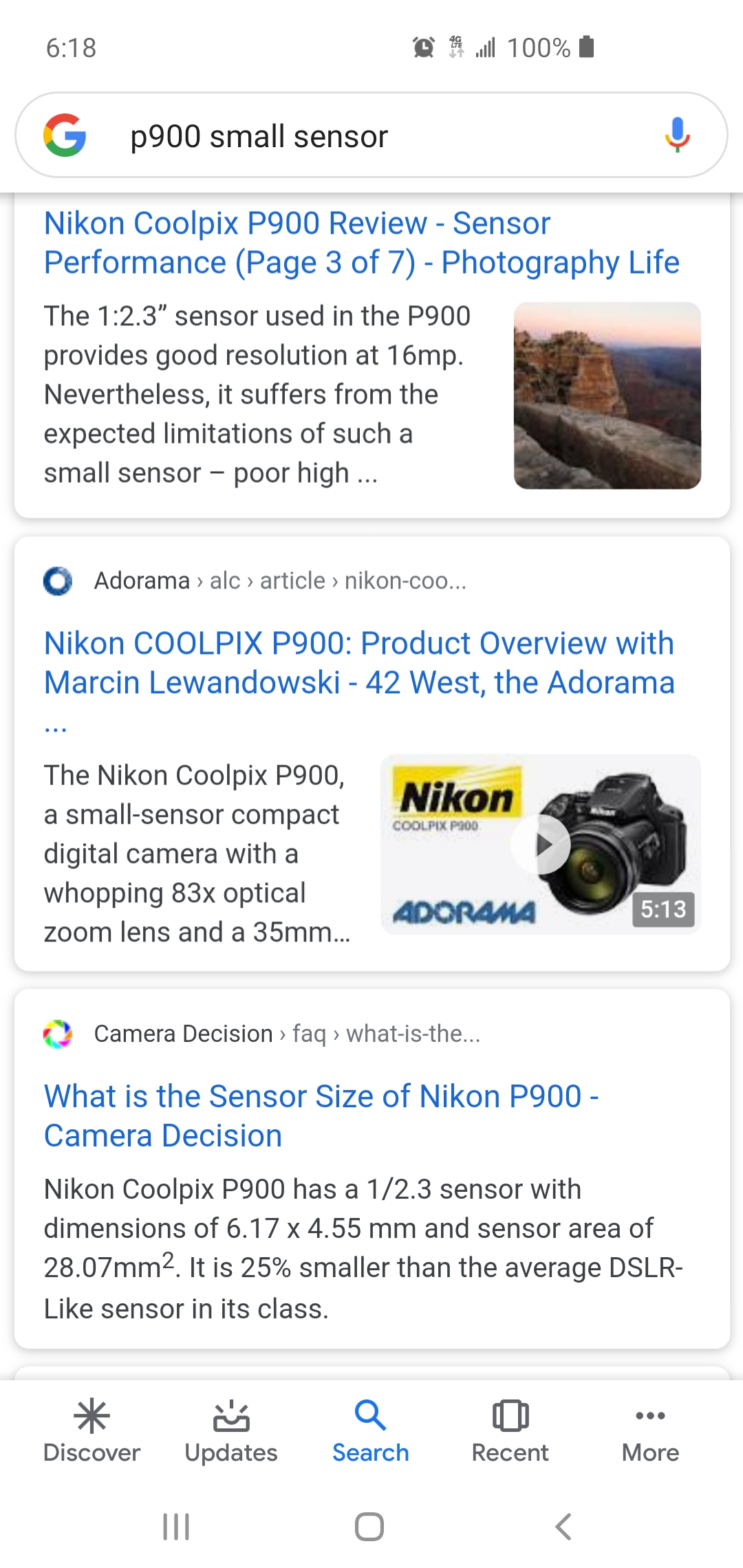
Yes… with my $500 camera that is notorious for having a pathetically small sensor for this day and age…

There are tons of photography articles condemning the P900’s very small sensor. It’s 16 megapixels… compared to slightly more expensive cameras with 50 megapixels. It’s a trade-off for the extreme zoom capabilities. They had to fit a lot of lenses in there, limiting the room for the sensor.
AND I’m supposedly 240,000 MILES AWAY from my target! There are those who shoot the moon with 50 megapixel cameras, and you CAN zoom way in on the photo without pixelation.
So send me a signal to let me know that you understand so far – and then I’ll continue.
Do you understand that with even a cheap 50 megapixel camera, we can shoot the moon from 240,000 miles away, zoom in on the picture, and have very hi res quality with virtually no pixelation?
January 13, 2020 at 2:37 pm#849365 mikeboll64Blocked
Here’s the Cannon EOS 50 megapixel sensor. $2000…
 January 13, 2020 at 2:44 pm#849366
 mikeboll64Blocked
Do you suppose Google Earth can afford $2000 for their Loon program? Or do you think they’re using those disposable cardboard party cameras?
Now to the next step….
Which is closer – me to the moon or a Loon balloon to the earth?
The latter? Well done.
Now, can we take a better quality photo of, say, a mountain from 5 miles away, or from 250 miles away?
Let’s pause here for a second. I don’t want to pass you by again.
January 13, 2020 at 3:07 pm#849367 ProclaimerParticipant
Google get images from third party providers. Do you think it possible that they may not have every square inch of earth at the lowest altitude?
I’ve been using Google Earth almost at the moment they purchased it off Keyhole Maps and then made it free. All images were okay but then pixelated when you wanted to look at your house. Slowly but surely they have been making these lower altitude images available and priority were cities. In fact it made the news when your city became available.
The fact is, I’m still waiting for my house to get photographed so I’m not surprised much of Antarctica is not available.
I would go as far to say that there is way more demand for clear images in Wellington New Zealand than there is for Antarctica. It’s called supply and demand.
Nothing to see here folks. Bad imagery of Antarctica because Flat Earth is not a coherent argument.
January 13, 2020 at 3:10 pm#849368 ProclaimerParticipant
Do you suppose Google Earth can afford $2000 for their Loon program?
Do you mean that Loon program you use all the time?
- AuthorPosts
- You must be logged in to reply to this topic.

