- This topic has 6,423 replies, 23 voices, and was last updated 3 weeks, 1 day ago by
 Proclaimer.
- AuthorPosts
- May 13, 2019 at 12:47 pm#845328
 ProclaimerParticipant
Brilliant video Mike. Plenty of legs left in this debate it seems.
One thing to consider Mike with all figure based calcs aside, if the tree line is half way down the mountain in reality, then how come it is near the bottom of my photo?
This simple observation that dazza points out is still valid right?
I’m guessing ‘compression’ is your answer. Is that a correct assumption?
May 13, 2019 at 1:27 pm#845331 ProclaimerParticipant
Hi Mike.
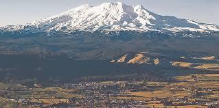
Take a look at this image. It shows Ohakune in relation to Mt Ruapehu and remember that Ohakune is shy of 2000 feet above sea level.
As you can see, there is heaps of forested slopes on the lower mountain, even more than half the mountain perhaps, although that could be due to be at a high elevation. I think it is correct to say that the higher up you go, the more the flat ground below you will look like it is part of the mountain. As I am say 200 metres high in my pic, that would to some degree exaggerate the trees and the foreground IMO making them seem like they are more part of the mountain than they really are (as these pics suggest), yet we have an opposite effect in my photo. What we see is a thin band of trees, which is perhaps just the very top part of the forest. So that means that the rest of the forest is hidden, Ohakune is hidden, and near 2000 feet of landscape below Ohakune is hidden. But hidden by what? The mystery continues.
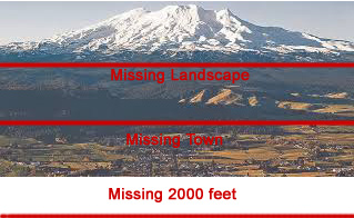
Think about this fact. If the top red line matches sea level in my photo, then all the land below and the town of Ohakune, plus 2000 feet below is under water. Al Gore might believe that, but that simply isn’t the case. Do you agree?
May 13, 2019 at 2:10 pm#845342 ProclaimerParticipant
For a comparison
Remember that the sea at the base of the land has to be sea level.

Where is all the forest? Where is all the landscape gone? Where is Ohakune? They are below the curve, right?
May 13, 2019 at 2:16 pm#845344 mikeboll64Blocked
T8: Brilliant video Mike. Plenty of legs left in this debate it seems.
Thanks T8… I’m nothing if not resilient. 😎 What did you think of the one piece of ground all the way to the right in your photo? That’s obviously not part of the Ruapehu treeline, right? Yet there it is, plain to see. So that is obviously a part of this land that you guys think is behind the curve, right?
Also, you surely didn’t go all the way up there to take one single photo, right? Can you show us the others? Do you have any showing a little more to the right, so we can see land all the way to Ruapehu?
May 13, 2019 at 2:27 pm#845346 ProclaimerParticipant
The start of the forest
Mike, take a look at where the tree line starts in relation to Ohakune. The ski lodge is at the base of the mountain or just before.
May 13, 2019 at 2:34 pm#845347 ProclaimerParticipant
See the extent of the forest for yourself
Behind you is the edge of town, that is 2000 feet above sea level. Ahead of you is the steady climb through thousands of feet in altitude of forest. Watch the trees get smaller as the climate gets colder. Navigate your way up till you reach the lava rock slopes and the snowy peaks. I bet you will give up though, it takes a while. Make a coffee before you start.
When you get to the carpark above the trees, ask yourself if my photo captured all of this forest.
May 13, 2019 at 3:02 pm#845351 Dig4truthParticipant
Mike, I just watched that last video and you nailed it. Seeing is believing and I’ve seen the light!
Keep up the good work, you are an encouragement to us who seek the truth and if I might add, your voice is a spectacular addition to YouTube.
May 14, 2019 at 2:10 pm#845394 mikeboll64Blocked
D4T, thanks a heap for your encouragement!
T8, what do you suppose that land mass is at the right of the mountain in your photo? It can’t be part of the treeline of the mountain, because it can’t even be part of the mountain, right? What then? Any ideas?
Btw, I think dazza is mad now. I skyped him this morning about my upcoming moon vid, and haven’t heard a word. He usually gets right back to me. 😁
May 14, 2019 at 8:23 pm#845400 ProclaimerParticipant
Nah, he’s not mad. I sent him the date in my camera so he could work out what time the photo was taken. He apologized for not replying quickly saying he was busy, but wanted to get right back into it.
May 14, 2019 at 8:29 pm#845401 ProclaimerParticipant
Hi Mike.
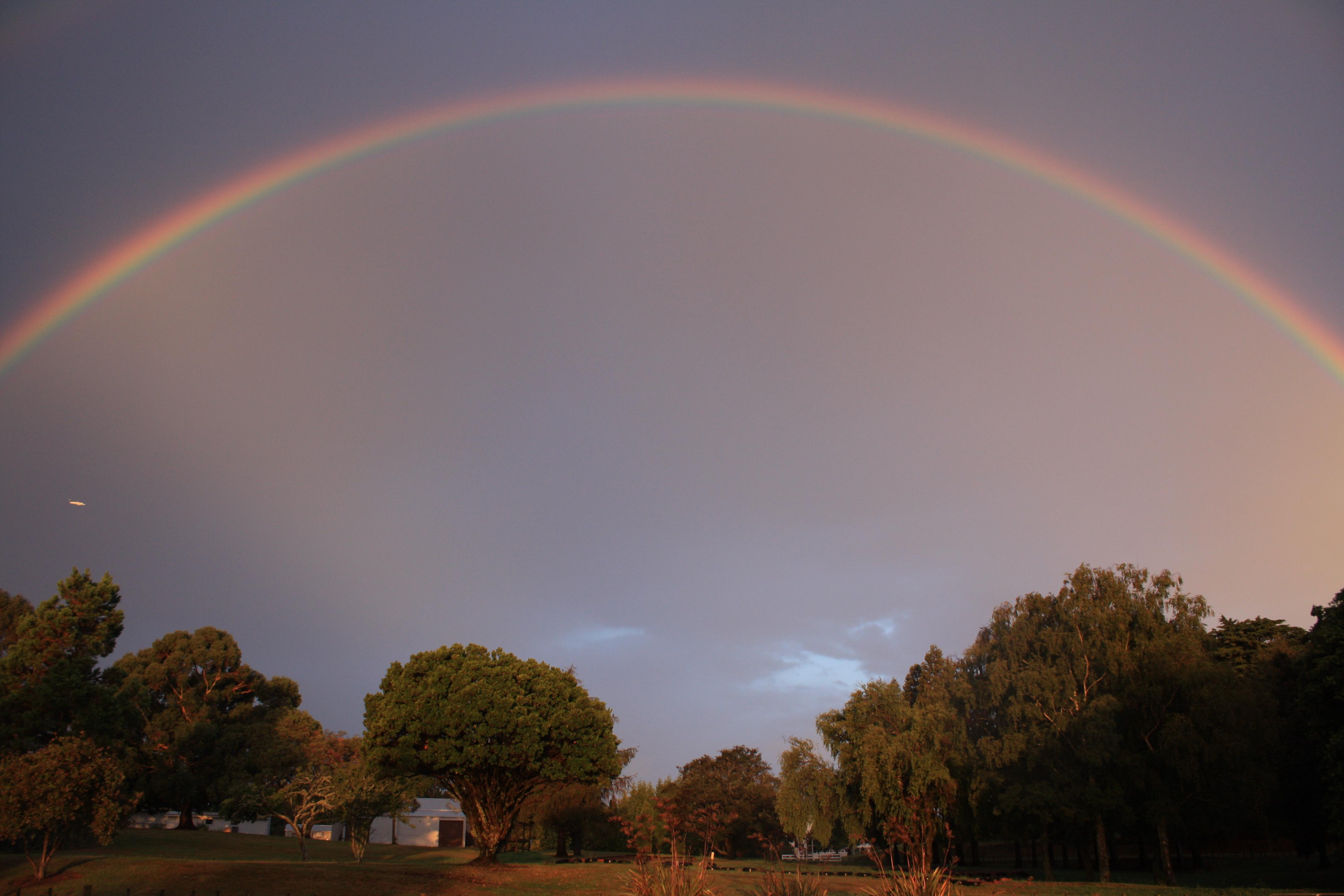
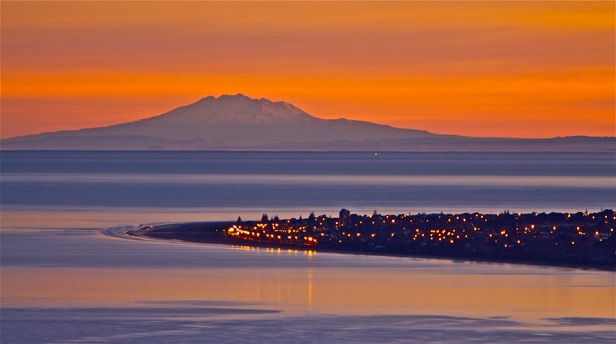
I was checking out if I took any other photos that day and came across this photo of the dome.
 May 14, 2019 at 10:05 pm#845402
 Dig4truthParticipant
That’s a beauty t8!
May 14, 2019 at 10:08 pm#845403 ProclaimerParticipant
I had a look at all unprocessed photos taken that day and there are a few, but none of Ruapehu. So yes, I took one photo of that. Then I drove down the hill and headed north to an area of mountains and trekked in for a bit and took a number of photos there. I don’t think they would be very helpful.
BTW, according to Google Earth, there are some hills or mountains ranging around a few hundred metres to 1000 metres high running in two bands in front of the volcano, but perhaps in front of the horizon or only partially obscured by the horizon. Perhaps its them? This pic shows these hills better. Perhaps you can get a match looking at Google Earth using this pic.
 May 16, 2019 at 6:32 am#845424
 Dig4truthParticipant
That’s a whole lot of mountain there!
May 16, 2019 at 12:34 pm#845426 ProclaimerParticipant
But not the whole thing.
What is hiding the bottom part of this mountain?
May 16, 2019 at 2:19 pm#845427 ProclaimerParticipant
Hi guys.
I finally put this image up on my New Zealand photo website.
Let me know if there is any error in the description.https://www.virtualoceania.net/newzealand/photos/coast/kapiti/nz3235.shtml
May 16, 2019 at 2:52 pm#845428 mikeboll64Blocked
Lol T8! I just got done with a 13.5 hour work day, following a bunch of 11 and 12’s. ImI short on time but will respond when I can. 😁
May 16, 2019 at 3:07 pm#845430 ProclaimerParticipant
Is that 13.5 hours on a flat earth or globe?
May 16, 2019 at 3:12 pm#845431 mikeboll64Blocked
We’re all flat earthers… it’s just that some of us don’t know it yet. 😁
May 17, 2019 at 7:04 am#845438 Dig4truthParticipant
😃
May 19, 2019 at 6:45 am#845469 mikeboll64Blocked
T8, your second shot is beautiful! Can you really not see the mountain AND the land it sits on as that 62 miles of land slopes all the way down to the sea? Heck, I think I can see the freakin’ beach in that shot! 😃 Can I use that for another video?
- AuthorPosts
- You must be logged in to reply to this topic.

