- This topic has 6,419 replies, 23 voices, and was last updated 1 month ago by
 Proclaimer.
- AuthorPosts
- January 14, 2020 at 10:14 pm#849371
 ProclaimerParticipant
6 Times We Saw Too Far Utterly Debunked
The first mountain that we shouldn’t see is Ruapehu and we know that was debunked some time ago.
Now in one short and interesting video, we have 5 more mountains debunked. Some of these mountains have been quoted as evidence to promote the Flat Earth by Mike.
Enjoy.
I feel that this debate can be wrapped up now.
Flat Earth debunked.
What would you guys like to debate next?
January 15, 2020 at 1:29 am#849373 Dig4truthParticipant
t8, you’re forgetting that Mike has done his own experiments at the Salton Sea with the mirror flash from 18 miles away which negates your premature claims of victory.
January 15, 2020 at 1:34 am#849374 mikeboll64Blocked
They got a 27 mile laser and mirror at Salton Sea 2 days ago. 👍 Videos coming soon.
January 15, 2020 at 11:14 am#849375 Dig4truthParticipant
Wow! Can’t wait for that one! That’s going to have to be some very bendy light!
January 16, 2020 at 5:06 pm#849377 ProclaimerParticipant
5 times we saw too far debunked again
Following up on the response.
Seeing too far remains debunked.
The video also debunks ‘Bubbles in Space’
I think that is everything debunked now.
Any other subjects you wish to discuss?
January 18, 2020 at 12:17 pm#849385 mikeboll64Blocked
t8: Read my post again. Flat white plains is not high priority on image upgrades when populated areas are in need of attention.
If you can’t see that, then you have to be blind. It’s obvious.
Okay, we’ll continue on in micro baby steps then…
Which is closer… me on earth to the moon (240,000 miles), or a space satellite to Antarctica (250 miles)? Which one, please?
January 18, 2020 at 12:45 pm#849386 ProclaimerParticipant
Your wasting your time with this line of reasoning because it is not only Antarctica that has bad imaging.
And do your own homework as to why there are less images closer to the ground than higher ones. I can think of a couple off the top of my head.
- Satellite takes say one photo at a higher altitude. But dozens to hundreds more if they zoom in closer to the ground and photograph. More costly and more work.
- Some satellites are probably only designed to take at a certain altitude and may not have the extra lenses and software to go closer. Who knows.
- I’m guessing the closer the imaging to the ground the more rules and regulations kick in regarding privacy and secrecy.
It is a no brainer when you look at the history and progress. It started with no close to the ground imaging to progressively adding in cities and important places like the Grand Canyon to filling in all the gaps. Obviously not there yet but getting there. Be patient Mike.
January 18, 2020 at 12:56 pm#849387 mikeboll64Blocked
Okay then… we’ll give you an undeserved benefit of the doubt, and just assume you know that 250 miles away is much closer than 240,000 miles away. That means that even with a crappy $500 camera, a space satellite taking photos of anywhere on earth will result in clarity almost 1000 times better than my photos of the moon. Can you agree with that?
January 18, 2020 at 1:26 pm#849388 ProclaimerParticipant
Your point is still moot. I’m betting that covering every square inch of earth in High Res close to the ground imaging increases the database many times over than all other images at all other high altitudes combined. Simple as that really. Just be patient. I’m waiting for my house to get photographed and hundreds of penguins on featureless white plains are waiting too. But it will likely happen.
January 18, 2020 at 1:32 pm#849389 ProclaimerParticipant
Some parts of the Sahara Desert have as bad imagery as some parts of Antarctica .
Could it be that there is a pillar in Africa that holds up part of the glass dome?
Thoughts?
January 18, 2020 at 2:00 pm#849390 mikeboll64Blocked
Okay… now we’re going to assume that you also realize that the clarity of the space satellite photos would be almost 1000 times better than my photos of the moon – and that’s assuming that they put $500 cameras with tiny sensors on those billion dollar pieces of equipment. Here’s an article about a satellite from 6 years ago…
https://www.techtimes.com/articles/12938/20140813/digitalglobe-launching-hi-res-satellite.htm
Among the satellite’s new features is its ability to capture images at 31-cm resolution, about a foot. This is the highest resolution commercially available. For example, it can hone in on a car windshield, grab a picture of a license plate, and can even see home plate on a ballfield. The satellite’s infrared sensor allows it to take images through haze, fog, dust, smoke and other airborn particulates, which should be a boost for emergency crews fighting forest fires, for example, and for Google.
It will also be able to identify a specific tree’s class and species as well as determine if the tree is healthy or not, the company says.
And this space satellite is supposed to be 383 miles high! So if it can make out a license plate from 383 miles up, and it can “take up to 680,000 square kilometers of imagery every day”, and this is just one of many thousands of satellites up there, why do we see this in the middle of Antarctica?
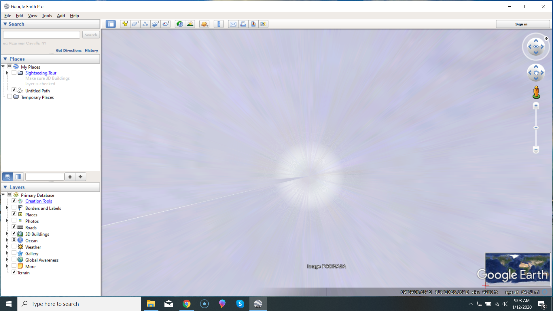
Your “pixelation” argument doesn’t work, because this isn’t pixelation! This is a whole bunch of nonsensical CGI! Now remember, that the 6 year old satellite mentioned above could read the license plate off a snowmobile that happened to be buzzing through the interior of Antarctica! That means a rock or person or machine or hut or snowdrift or whatever would show up in great clarity with that 6 year old camera. (I keep emphasizing the age, because you and I know that a 6 year old camera is crap compared to what you can buy today. And the one we buy today will be way outdated by the one coming next year, right?)
Also, your “money/cost” argument is nonsense – and you know it. If a camera can “capture images at 31-cm resolution”, then it will capture EVERY shot at that resolution – without costing even on single penny more. The images are digital! There is no actual “cost” to taking the photos at all… or sending them to the earth.
Finally, your “closer photos in populated areas” argument is equally laughable, since what flippin’ good are all those space satellites if you need to fly planes and balloons over places to get good photos? If we NEED the balloons and the planes, then there’s no use for the 13,000 space satellites, right?
So now you need only reconcile the fact that we DO need those balloons and planes, hence the Google Loon and NASA’s SOPHIA programs!
Checkmate.
January 18, 2020 at 2:06 pm#849391 mikeboll64Blocked
Dude, that 6 year old satellite’s sensor is one square foot! The sensor in my P900 – which takes very clear photos of the moon – is about 5 square millimeters! 😁😂🤣
January 18, 2020 at 2:08 pm#849392 mikeboll64Blocked
Oh… and the satellite’s square foot sensor is also 626 times closer to its subject than my 5 square millimeter sensor! 😉
January 19, 2020 at 12:14 am#849393 ProclaimerParticipant
Get over it. Google have their business reasons for adding the final layer of images in stages. You could probably even Google the answer if you were really interested in the truth.
January 19, 2020 at 4:29 am#849394 mikeboll64Blocked
Yes of course. Just like NASA and all the other space agencies of the world have their reasons for not putting a slew of stationary hi res cameras on the moon so we could study cloud patterns, electromagnetic activities, solar flares, tides, and basically just watch the spinning ball earth rotate round and round in real time. This would be HUGE for scientific investigation! And Elon Musk had his reasons for sending a Tesla to Mars with cameras that only lasted 12 hours. And they have reasons for never having dedicated cameras pointing forwards and backwards on all these rockets buzzing back and forth to the ISS so we could see the earth getting smaller and the ISS getting larger during their approach… and see the docking maneuvers in real time. And I’m sure there were plenty of good reasons that there is zero photographic evidence of the ISS (the greatest achievement of mankind) being built, hauled to space, and put together piece by piece in outer space. And plenty of good reasons for not having continuous feeds from all these probes that we send to Mars and comets and meteors and Saturn and Pluto, etc.
It’s like the BBC producer of that Amazon documentary only including a few fuzzy still shots of some foliage here and there (where you can’t make out what you’re even seeing), and you applauding the documentary anyway and explaining that you’re sure BBC had it’s reasons for not filming the entire adventure, but instead using cheesy CGI graphics and animations to show you what the Amazon jungle really looks like.
Look tater, we send vessels to the very depths of the sea, and what do they all have in common? Beautiful filmography of strange looking deep sea creatures that make us all go “oooh” and “ahhh”…


We’ve had scores of scientists in and around Antarctica since 1940… studying ICE! Is it really too much to ask that in 80 years of continuous study by multiple nations we might have some nice aerial footage of the interior?
Of course they have their reasons, right? But has it dawned on you that the reason we don’t have all this footage that is easy to get and doesn’t cost a dime is because the things this footage would show simply don’t exist? Because it has dawned on us who have open minds and a Biblical worldview.
No continuous REAL footage of our spinning ball – because the spinning ball simply doesn’t exist. No footage of our approach to Mars because Mars is a light in the sky, and nobody’s ever been there. No footage of the ISS being built in space because the ISS doesn’t exist. No footage of the interior of the Antarctic continent because there is no such continent.
See, these would be EASY ways for NASA and others to PROVE that we live on a spinning ball, right? But they don’t do these things. And we both agree that they have their reasons for not doing them. They also have a reason for never having put one of their ISS astronauts in his space suit inside NASA’s huge vacuum chamber so we can see for ourselves the soda can exploding while the astronaut holding it remains perfectly fine in his flexible vacuum suit. Yeah… there are definitely reasons for them not doing this super easy stuff to PROVE their stories. The reasons are THEY CAN’T.
January 19, 2020 at 8:34 am#849395 mikeboll64Blocked
There are 93,000 square millimeters in one square foot. My P900 sensor is 28 square millimeters. So the camera on that 6 year old satellite is 3300 times better than my camera, which takes very clear images of a moon that is 626 times farther away than the satellite is to the earth!
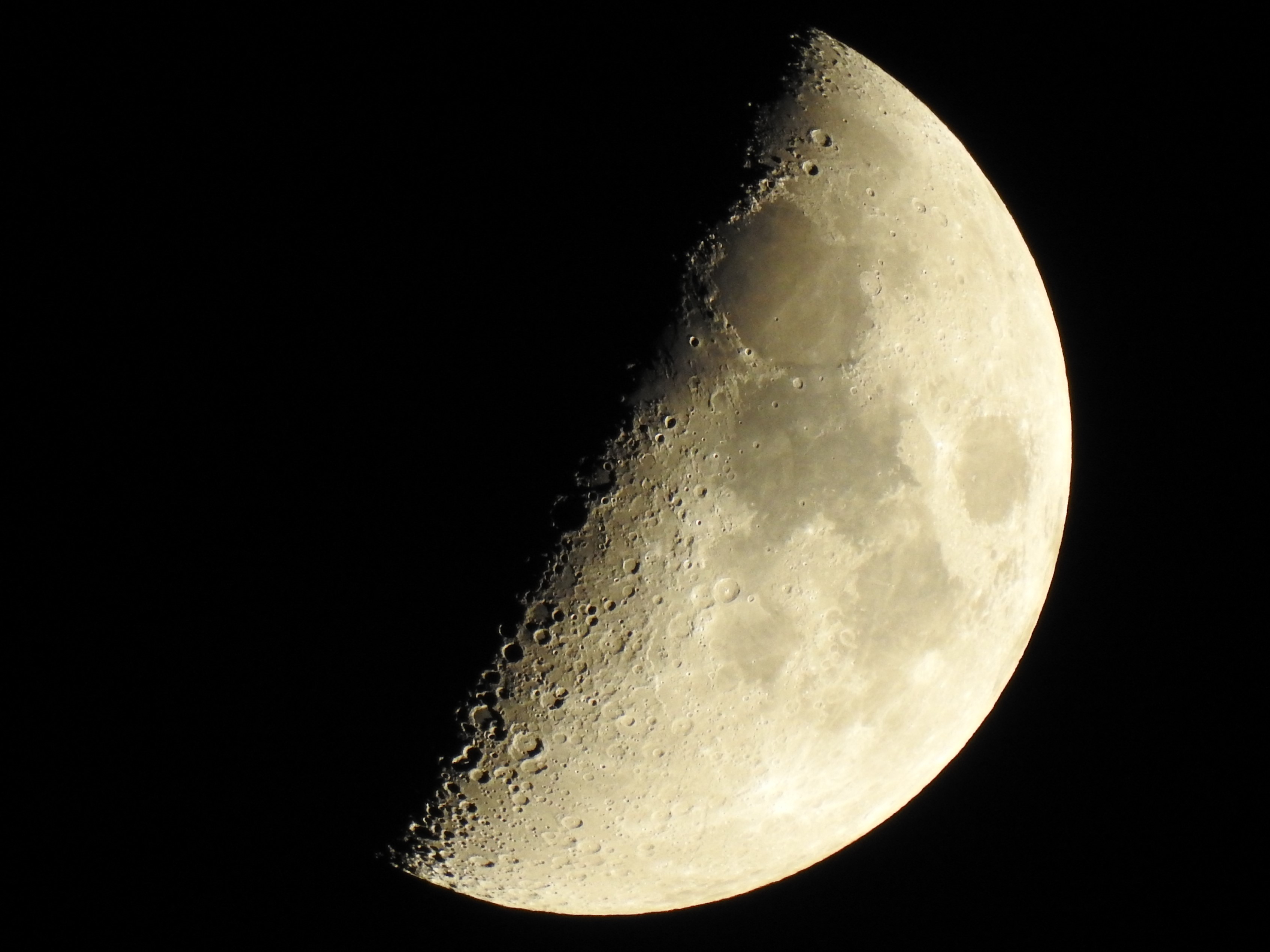
But tater is sure they have some valid reason for this nonsense…
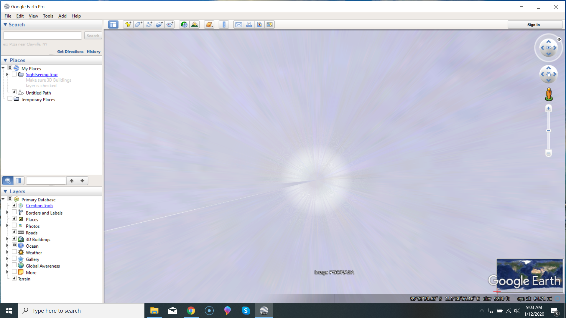
Taters gonna tate. 😁😂🤣
January 19, 2020 at 10:21 am#849396 ProclaimerParticipant
Your argument that Google Earth doesn’t have 100% coverage of high-res closeups of every square inch of Earth proving Antarctica is off limits thereby proving the Earth is flat is certainly entertainment with much fodder for ridicule.
But try and be sober minded for a sec. Google Earth had zero of these particular images and now much of the Earth is done. Just wait, populated areas will take precedent, but I’m sure the penguins on flat white plains haven’t been forgotten.
From zero to all has many stages in between. When you start your car, do you hit 100kmh immediately or do you build up to that speed. Something for you to think about.
January 19, 2020 at 10:40 am#849397 ProclaimerParticipant
Greenland and Antarctica have bad imaging in Google Earth
Why? Here are some possible reasons for those who claim to be wise and intelligent.
- Antarctica is not a continent and the dome and ground interface here. The lizard reptile humans do not want us to know how special we are because we sit in a snow globe.
- Greenland houses the entrance to the Hollow Earth. Google are not allowed to show high-res close imaging of the ground otherwise many explorers would arrive on Greenland and enter the earth and discover the underground cities and humans who live there including many Nazis who fled there after WWII.
Of course while both these are possible even both could be true concurrently, many are trying to understand how a flat earth can be hollow as well. Of course there exist these nutters who proclaim that populated areas get priority for close up imaging and that close ups of white plains in high res are just white anyway because there are no features present for contrast.
Thoughts?
January 20, 2020 at 5:14 am#849406 mikeboll64Blocked
Tater, they don’t have any of the footage that I mentioned above simply because you can’t have real footage of things that don’t exist. Maybe this will help…
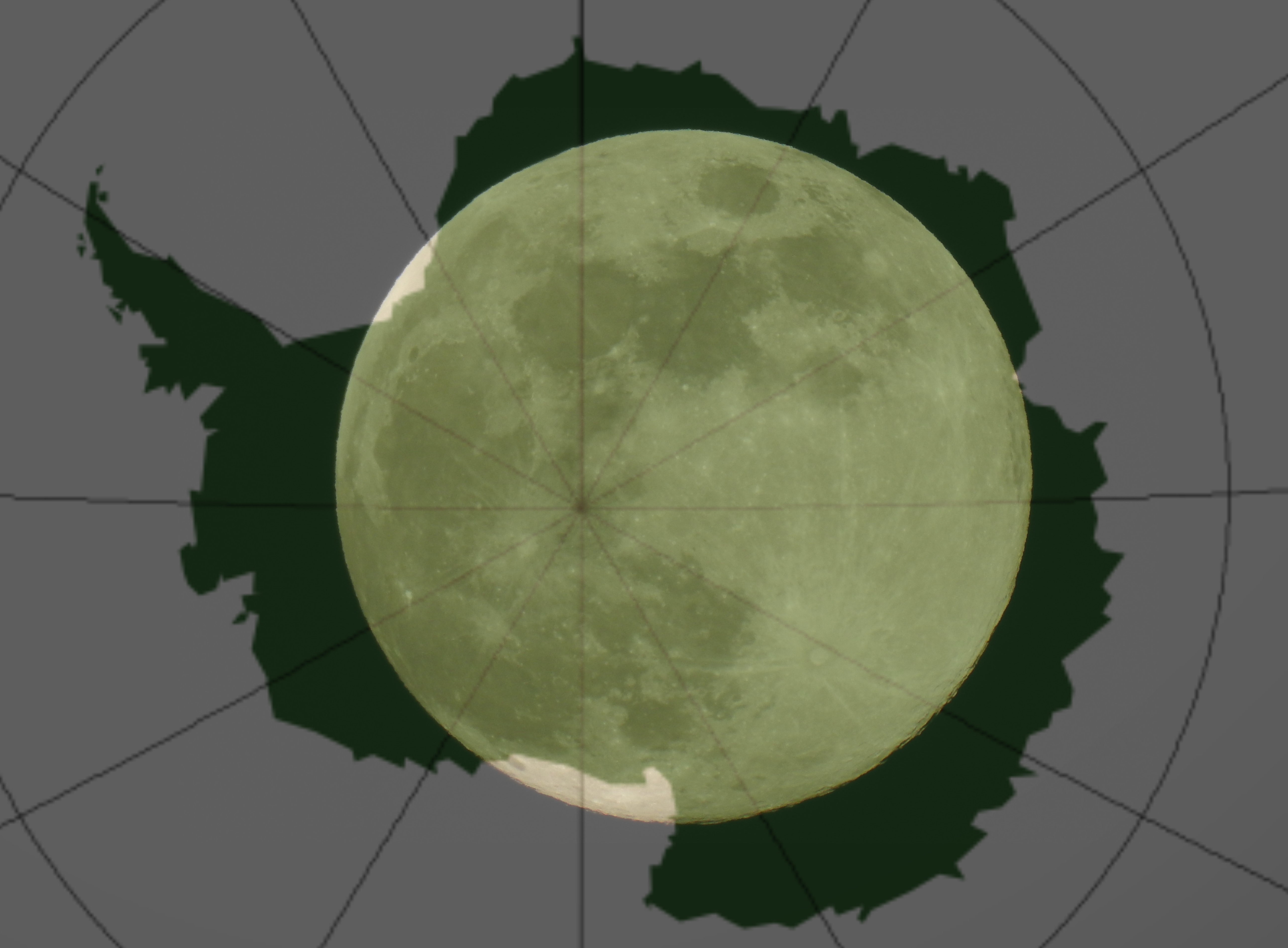
This is an actual size comparison of Antarctica overlaid on a photo of the moon I took. The diameter of the moon is 2158 miles. The diameter of Antarctica is 2768 miles. So what you’re trying to sell us is that I, with my $500 camera that has a 28 mm² sensor can capture great detail of the moon which is 240,000 miles away from me… and NASA, with their million dollar camera that has a 31 cm² sensor CAN’T capture ANY kind of detail at all of Antarctica which is only 383 miles away from it.
Nobody’s buying what you’re selling, man. The amount of people in a place doesn’t affect the camera resolution. The photo of, say, Australia is taken at the given resolution. The camera can’t decide to make certain parts of the photo clear and other parts of it crappy. I can’t take a photo of the moon and tell my camera to make the craters clear, but fuzz out and pixelate the non-crater areas.
So let’s start here – since you keep circling around because you don’t want to ever give a straight answer…
Are the Google Earth images the product of space satellites? Or of balloon and plane footage? Please answer directly and honestly to the best of your ability.
January 20, 2020 at 8:27 am#849409 ProclaimerParticipant
Mike has failed
Mike, I don’t know where Google get their images from and I don’t care. Explain why Greenland has bad imaging. Lol. It’s staring you in the face, but whatever.
If this is all you have then you have failed to prove the flat earth. Admit it.
You have no photos of the disc or dome.
No explanation as to how I get from New Zealand to South America in the time I do when the flat earth edge of the disc puts both countries 3 or 4 times the real distance apart.
No proof of the massive scale of conspiracy it takes to cover up the whole space, satellite, and airline industry as well as the military barrier that stops boats from sneaking onto Antarctica.
No proof of the sun speeding up when it’s orbit is over the Tropic of Capricorn compared to when it is over the Tropic of Cancer.
No explanation of how eclipses and a curved shadow works on a flat earth.
No unifying flat earth theory at all, rather a bunch of disparate models that explain different aspects of it, but are all different and cannot agree.
Finally, the globe model has proof for all of the above. We have photos, videos, southern hemisphere travel times, math that predicts eclipses and can be shown visually. Our one theory explains everything with ease because that is what truth does.
You Mike rely on ignorance, lies, and misunderstandings. Now all you can give me is your camera specs and how Google Earth should be better as if this was some kind of valid argument. It is not. It is not science and is worse than scientism.
Pathetic. You have lost all credibility. You think I’m being tough? I am. I am tough when it comes to BS. Lies are from the evil one so I don’t hold back.
- AuthorPosts
- You must be logged in to reply to this topic.

